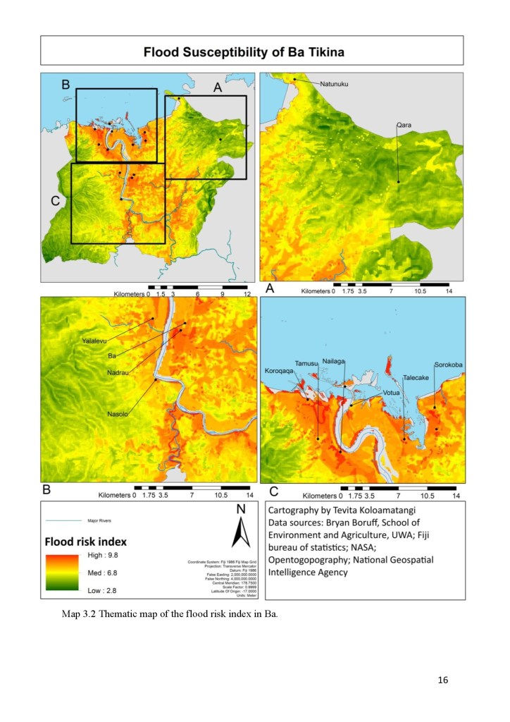
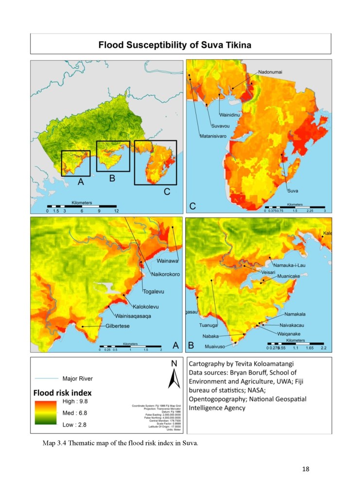
The quality and availability of data can make it difficult to adapt and mitigate against the impacts of climate change. In this exercise, a method was developed to map and predict the spatial extent of flood risk in Fiji using commonly available data such as digital elevation models.
New Methods for Spatial Modelling of Natural Disaster Risk: A case study of Fiji